I had a lot of fun rectifying historical maps on the David Rumsey Georeferencer webpage. When I was browsing through the David Rumsey Map Collection, I was blown away by the variety of maps and the extensiveness of this collection. Using modern technologies to overlay historical maps on modern maps seems like a great way to analyze changes over time and study the history of cartography.
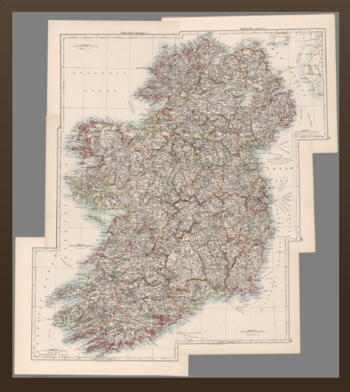
The map that I worked on during class is a map of Ireland depicted and published in 1906 based on its metadata on the website. This process definitely changed my understanding of spatial digital humanities projects. Before I only pictured spatial projects as 3D or 2D mappings of certain subjects. I did not expect to use 2D mapping on antique maps.
According to the website, this map can be used in GIS apps and be exported to a GeoTIFF file. It can also be viewed in many formats, including iiif viewer, iiif info json, and the website format. Therefore, there are a lot of ways to access the map that I rectified. I can see how this map is useful in the field of cartography studies. One is able to see how historical maps differ from modern maps in terms of names, scales, notations, styles, and etc. It is easier for us to construct and understand the ancient worlds with the aid of georeferencing.
Concerning this specific website for georeferencing, there are some technical obstacles. For example, with maps with a polar projection, it is extremely hard and probably inaccurate to use this website for georeferencing. One should also be equipped with the knowledge to distinguish real-world maps and fantasy maps, because certain maps might contain inaccurate or imaginary information due to various reasons.
Georeferencing is probably not suitable for analysis of certain trends over time such as the number of military forts and towers in the Roman Empire, because most maps only depict one place in one time in history. One would need to overlay or compare multiple maps over time to see any trend, which seems more laborious than directing looking at data.
Hi Jeanny! I agree with your point that Georeferencing is probably not suitable for analysis of certain trends over time as the maps that we use are just representative of only one period in history, and that using multiple maps is a burden and a lot of work. I too used a historic world map and rectified it onto the modern world map, and saw some difference in the landscape, but could not find the changing trend as I was using only one map. Great point!
I was actually surprised that it can be viewed in various formats, I did not notice that there are so many different ways of viewing it. This is also the first time for me to deal with antique maps using 2D mapping! I really like the point that you mentioned about the technique obstacles of georeferencing, and it is not suitable for analysis on certain trend, which I strongly agree.